
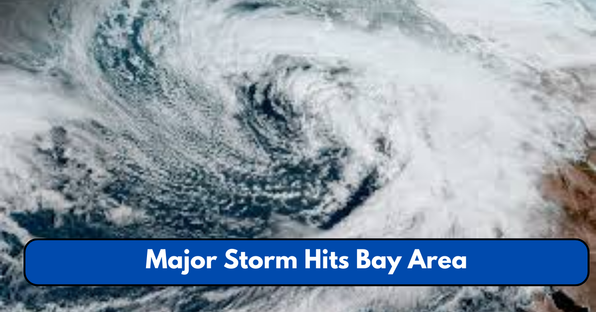
The San Francisco Bay Area is under severe weather conditions as a powerful atmospheric river storm sweeps through, bringing torrential rain, rising river levels, and widespread flooding.
The National Weather Service (NWS) has issued flood warnings and evacuation orders across multiple counties, urging residents in flood-prone areas to seek higher ground immediately.
Authorities warn that the storm will continue through Friday, with some regions experiencing more than an inch of rainfall per hour, leading to rapidly rising water levels in rivers and creeks. Here’s everything you need to know about the storm’s impact, emergency measures, and how to stay safe.
Evacuations and Rising Flood Risks
As heavy rainfall pounds the Bay Area, officials in Santa Cruz County have ordered evacuations for communities near the San Lorenzo River, where water levels have risen dangerously fast.
Other affected areas include Felton, Paradise Park, and Soquel Village, where flash floods pose a significant risk to homes and roads.
The Santa Clara Valley Water District has also issued warnings for residents near Coyote Creek and the Guadalupe River, as water levels continue to surge.
For the latest evacuation updates and official instructions, visit the California Governor’s Office of Emergency Services (Cal OES) at www.caloes.ca.gov.

Which Counties Are Under Flood Warnings?
The National Weather Service (NWS) has placed several Bay Area counties under flood watches and warnings, including:
- San Francisco County
- San Mateo County
- Santa Cruz County
- Monterey County
- Contra Costa County
- Alameda County
- Santa Clara County
Residents are urged to stay informed, avoid flood-prone areas, and prepare for possible evacuations.
Check real-time flood alerts and warnings from the NWS Bay Area Office at www.weather.gov/bayarea.
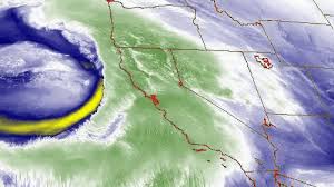
What Is an Atmospheric River and Why Is It Dangerous?
An atmospheric river is a narrow corridor of concentrated moisture in the atmosphere that can deliver intense and prolonged rainfall. This type of weather system is responsible for some of the heaviest storms in California, and when it stalls over a region like the Bay Area, flash flooding, landslides, and infrastructure damage can occur.
According to the National Oceanic and Atmospheric Administration (NOAA), atmospheric rivers can transport up to 15 times the amount of water found in the Mississippi River—leading to massive rainfall totals and rapid flooding.
For a scientific breakdown of atmospheric river storms, visit the NOAA website: www.noaa.gov.
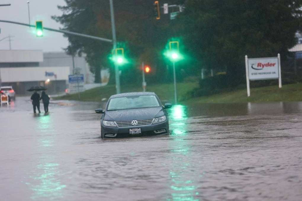
Storm Impact: Roads, Power Outages, and Public Transit Disruptions
The severe weather has already caused power outages, road closures, and transit delays across the Bay Area.

Road Closures and Transportation Delays
- Highway 17 (Santa Cruz Mountains) – Mudslides and flooding reported.
- I-280 & Highway 101 (San Francisco Peninsula) – Partial lane closures due to flooding.
- State Route 92 (San Mateo County) – Roadway submerged under water, major delays.
Power Outages
According to PG&E, thousands of customers across the Bay Area are without power, with the South Bay and East Bay experiencing the most outages. The company is deploying emergency crews but warns that power may not be restored immediately due to hazardous weather conditions.
For real-time power outage updates, check the PG&E outage map at www.pge.com/outages.
What Residents Should Do to Stay Safe
Authorities are urging residents to take the following precautions during the storm:
- Avoid driving through flooded roads. Just six inches of moving water can knock a person down, and 12 inches can sweep a vehicle away.
- Monitor local emergency alerts. Sign up for notifications through AlertSF (San Francisco) or Nixle (Bay Area-wide) for real-time updates.
- Prepare for power outages. Charge your devices and have flashlights, extra batteries, and emergency supplies ready.
- Have an evacuation plan. If you live in a flood-prone area, know your nearest shelter locations and prepare essential documents in a waterproof bag.
For a complete emergency preparedness guide, visit FEMA’s official website at www.ready.gov/floods.
Weather Forecast: How Long Will the Storm Last?
The National Weather Service forecasts that heavy rainfall will continue through Friday morning, with additional showers lingering into the weekend. Wind gusts could reach up to 55 mph, especially in coastal and mountain regions, increasing the risk of downed trees and power lines.
A high-surf warning is also in effect, with waves reaching up to 30 feet along the coast, creating dangerous conditions for beachgoers and boaters.
Final Thoughts: Stay Alert and Stay Safe
The Bay Area is facing one of the strongest storms of the season, with evacuations, road closures, and power outages already affecting thousands of residents. As floodwaters rise and high winds continue, it’s critical to stay informed, follow official warnings, and prepare for emergency situations.
For the latest emergency updates, follow:
- Cal OES (California Emergency Services): www.caloes.ca.gov
- National Weather Service – Bay Area: www.weather.gov/bayarea
- PG&E Power Outages: www.pge.com/outages
Stay safe, stay prepared, and keep an eye on official updates as this storm continues to impact the Bay Area.
This article has been carefully fact-checked by our editorial team to ensure accuracy and eliminate any misleading information. We are committed to maintaining the highest standards of integrity in our content.

A senior at Yale-NUS College with interests in developmental and labour economics, as well as creative non-fiction and poetry. Currently, I’m studying as an Economics major and an Arts and Humanities minor (focusing on Creative Writing) with heavy involvement in the Singaporean journalism scene and involved in research on economic history and educational policy. I’m working as an author for The Octant, Yale-NUS’ student publication, as a writer for Wingspan, Yale-NUS’ alumni magazine, and as a tutor for the NUS Libraries Writer’s Centre. | Linkedin