
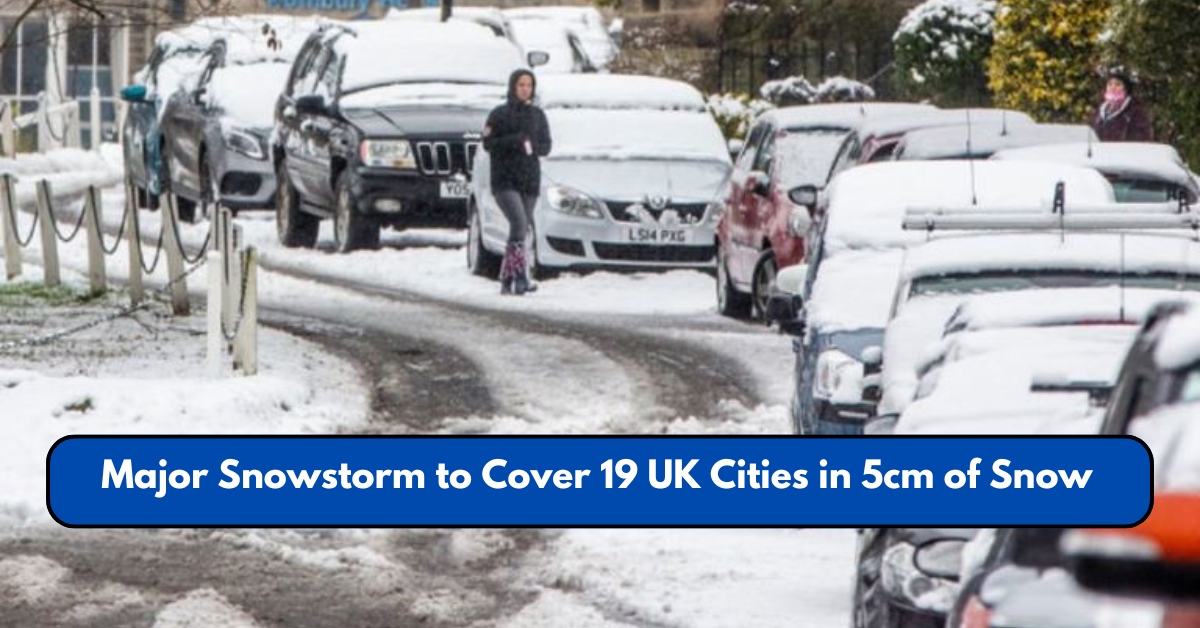
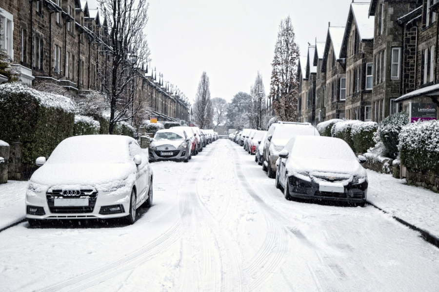
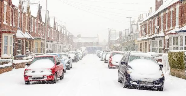
A major snowstorm is set to sweep across the United Kingdom, bringing up to 5cm of snowfall to at least 19 major cities. The Met Office has issued yellow weather warnings, cautioning residents about dangerous travel conditions, icy roads, and possible power disruptions.
The cold front, stretching 500 miles across the UK, is expected to hit Scotland, the Midlands, and northern England, with some areas experiencing heavy snow showers and freezing rain.
Here’s everything you need to know about the upcoming snowstorm, including which cities will be affected, what disruptions to expect, and how to stay safe.
Which Cities Will Be Affected by the Snowstorm?
According to the Met Office, the following 19 UK cities are expected to see significant snowfall and freezing conditions:
- London
- Birmingham
- Manchester
- Leeds
- Liverpool
- Sheffield
- Bristol
- Newcastle upon Tyne
- Sunderland
- Wolverhampton
- Nottingham
- Stoke-on-Trent
- Derby
- Southampton
- Portsmouth
- Plymouth
- Brighton
- Leicester
- Coventry
Snowstorm Forecast & Weather Conditions
The Met Office yellow weather warning states that snow, sleet, and freezing rain will create hazardous conditions, especially in northern England, the Midlands, and Scotland.
Expected Conditions:
- Snowfall Accumulation: 2-5cm of snow in most areas, with higher elevations experiencing more.
- Freezing Rain Risk: Ice buildup on roads and pavements, increasing the chance of dangerous travel conditions.
- Temperatures: Dropping below freezing (-2°C) in some regions, particularly Scotland and northern England. Wind Gusts: Strong winds may increase wind chill, making temperatures feel even colder.
How Will This Snowstorm Affect Travel?
The UK’s transport network is expected to be heavily impacted, with warnings issued for:
🚗 Road Travel – The Met Office warns of icy conditions, reduced visibility, and dangerous roads. Motorists are urged to avoid non-essential travel.
🚆 Rail Disruptions – Snow and ice may cause rail delays and cancellations, particularly in Scotland and northern England.
✈ Flight Delays & Cancellations – Airports such as Heathrow, Manchester, and Edinburgh may face disruptions due to de-icing operations.
🚌 Public Transport Delays – Bus and tram services could see reduced schedules or route changes due to hazardous conditions.
What Precautions Should You Take?
With the snowstorm expected to bring freezing conditions and potential power outages, residents are advised to take necessary precautions.
1. Stay Updated
- Check the Met Office and BBC Weather regularly for live updates.
- Follow local news and transport advisories for travel disruptions.
2. Avoid Unnecessary Travel
- If driving, ensure your vehicle is equipped for winter conditions (snow tires, antifreeze, extra fuel).
- Keep an emergency kit in your car (blanket, water, food, flashlight).
3. Prepare for Power Outages
- Keep batteries, torches, and warm clothing ready in case of power disruptions.
- Charge essential devices before the storm hits.
4. Protect Your Home
- Insulate pipes to prevent freezing and bursting.
- Stock up on essential groceries and supplies in case roads become inaccessible.
Long-Term Weather Outlook: More Snow or Milder Weather?
While the snowstorm will bring severe conditions over the next 48 hours, forecasts suggest a gradual warming trend.
📅 By Thursday: Temperatures in southern England could reach 10-12°C, while Scotland remains cold (0-3°C).
🌧 Rain & Wind: After the snowstorm, wet and windy conditions will dominate for the remainder of February.
❄ Risk of More Snow: Another cold snap is possible later in the month, depending on jet stream activity.
Conclusion
The upcoming snowstorm is set to impact 19 UK cities, bringing freezing conditions, travel disruptions, and hazardous roads. While the snowfall will be moderate (up to 5cm), the combination of icy conditions and freezing rain could make travel extremely dangerous.
Residents are urged to take precautions, stay indoors where possible, and follow Met Office updates for real-time information.
As the cold snap transitions into milder weather later in the week, the UK should prepare for additional rain and wind, though another winter storm is possible later in February.
This article has been carefully fact-checked by our editorial team to ensure accuracy and eliminate any misleading information. We are committed to maintaining the highest standards of integrity in our content.

A senior at Yale-NUS College with interests in developmental and labour economics, as well as creative non-fiction and poetry. Currently, I’m studying as an Economics major and an Arts and Humanities minor (focusing on Creative Writing) with heavy involvement in the Singaporean journalism scene and involved in research on economic history and educational policy. I’m working as an author for The Octant, Yale-NUS’ student publication, as a writer for Wingspan, Yale-NUS’ alumni magazine, and as a tutor for the NUS Libraries Writer’s Centre. | Linkedin