
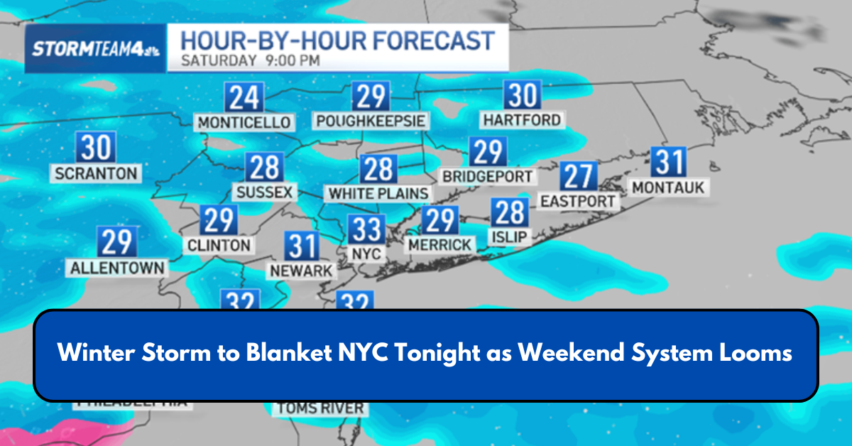
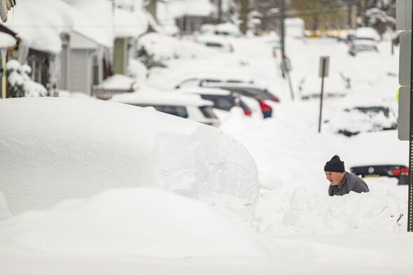
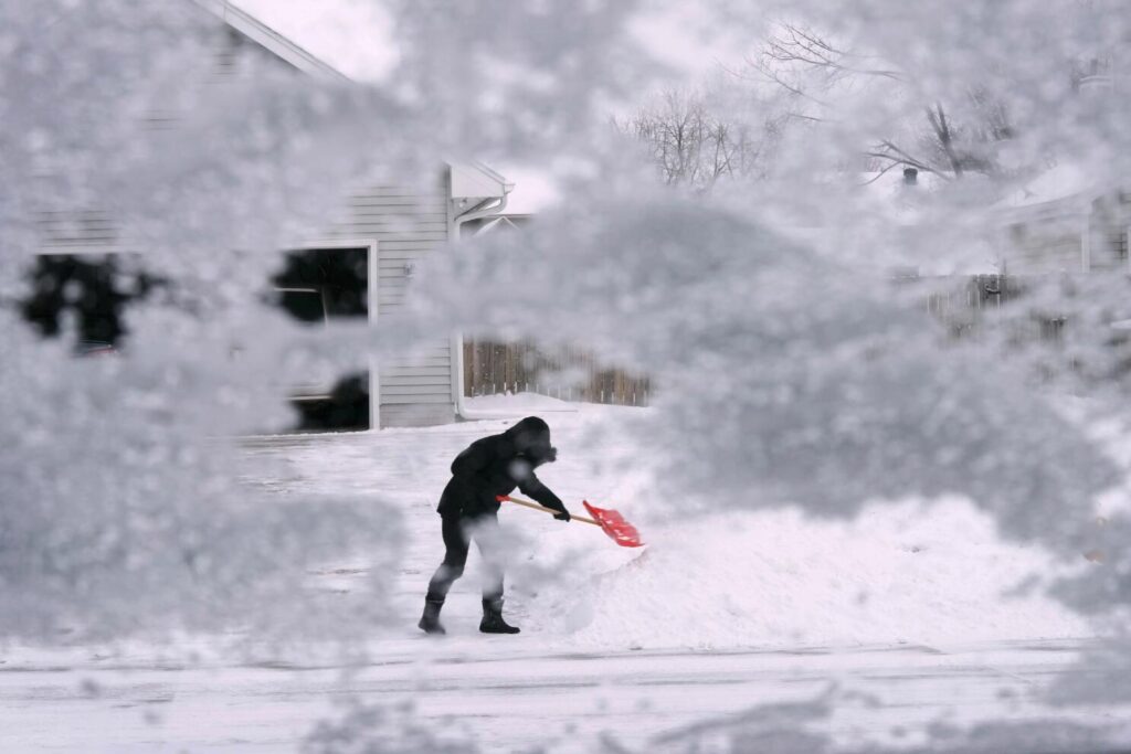
NEW YORK CITY – The New York City area woke up to snow-covered streets after an overnight winter storm, making for a slick and hazardous Wednesday morning commute. However, the wintry weather isn’t over yet.
Another round of snow, sleet, and freezing rain is expected to impact the region tonight into early Thursday, particularly in interior areas.
A Winter Weather Advisory is in effect from 7 p.m. Wednesday to 9 a.m. Thursday for parts of southern Connecticut, northeast New Jersey, and the Lower Hudson Valley.
When Will It Snow?
As the storm system moves in from the Midwest, it will bring milder air from the south, resulting in a mix of precipitation types—including snow, sleet, freezing rain, and regular rain.
Initially, snowflakes may fall before transitioning into rain, meaning New York City could see a brief period of snowfall before the changeover.
Forecast Breakdown:
- Wednesday Night: The storm, which already brought snowfall to the central U.S., is set to reach the East Coast tonight. The National Weather Service predicts a mix of snow and sleet that will transition to rain by early Thursday morning. Highs will be in the upper 30s, with a 100% chance of precipitation.
- Thursday Morning: Rain is likely, especially before 10 a.m., creating a messy morning commute. Cloud cover will gradually clear, with temperatures rising to the upper 40s. The chance of precipitation is 60%.
How Much Snow is Expected?
Most locations across New York, New Jersey, and Connecticut should anticipate up to an inch of snow and sleet, followed by a thin layer of ice in some areas.
“We’re looking at a rain/snow mix arriving later this evening, but it will quickly transition to rain,” said FOX 5 NY meteorologist Mike Woods. “Expect a wet Thursday morning, with periods of heavy rain.”
Another Weekend Storm? Here’s What We Know
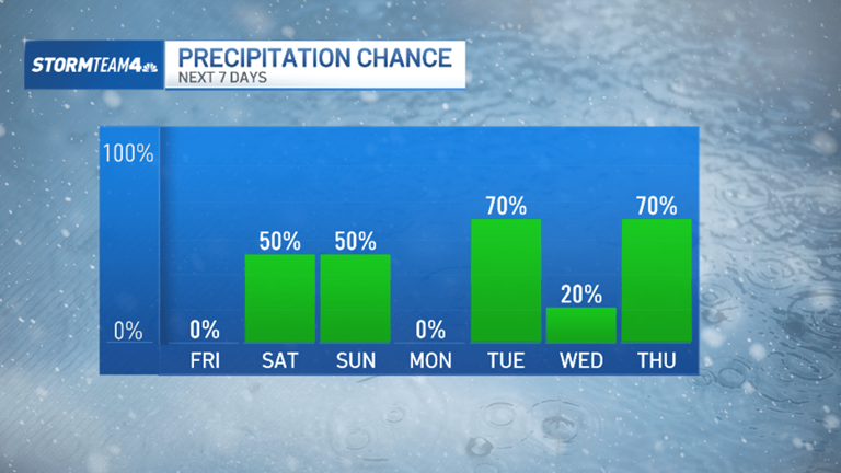
The active weather pattern continues into the weekend as another storm system approaches the East Coast.

Unlike this week’s storms, the upcoming system will rapidly intensify over the Deep South before heading north, according to the FOX Forecast Center. Instead of moving flat across the country, the jet stream will dip more sharply, altering the storm’s development.
Because this system will be stronger and positioned farther south, it will generate widespread rain on its eastern side as it moves toward the Northeast, reducing but not eliminating the chance of snow.
Weekend Timeline:
- Saturday Night: Rain expected. Low near 37°F. 100% chance of precipitation.
- Sunday: More rain throughout the day, with highs near 46°F. 100% chance of precipitation.
- Sunday Night: A mix of rain and snow is possible between 10 p.m. and 1 a.m., followed by mostly cloudy skies. Low near 24°F, with blustery conditions. 40% chance of precipitation.
Expert Outlook:
“Another storm system arrives late Saturday into Sunday, bringing another round of rain and snow to the Tri-State area,” Woods said. “This looks like another strong storm.”
This article has been carefully fact-checked by our editorial team to ensure accuracy and eliminate any misleading information. We are committed to maintaining the highest standards of integrity in our content.


Premlata is a seasoned finance writer with a keen eye for unraveling complex global financial systems. From government benefits to energy rebates and recruitment trends, she empowers readers with actionable insights and clarity. When she’s not crafting impactful articles, you can find her sharing her expertise on LinkedIn or connecting via email at [email protected].